Algarve-Tourist.com
The best independent guide to the Algarve
Algarve-Tourist.com
The best independent guide to the Algarve
Hiking the Seven Hanging Valleys Trail (Sete Vales Suspensos) - a guide for 2025
The Percurso dos Sete Vales Suspensos (Seven Hanging Valleys trail) is one of the most scenic hiking routes of the Algarve.
This moderately challenging hike trail of 11.5km (round trip) follows the stunning coastline between Vale de Centianes (Carvoeiro) in the west and the Praia da Marinha to the east. This coastline of turquoise seas and hidden cove beaches is formed of massive limestone cliffs, and cliff-tops lined with Juniper thickets and Aleppo pine forest.
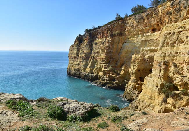
The Alfanzina headland with the distinctive yellow limestone cliffs
The Percurso dos Sete Vales Suspensos hiking trail passes many of the Algarve’s finest natural features, including the Benagil Cave, the double sea-arch at Praia da Marinha beach and the picturesque Praia do Carvalho beach. This is a dramatic clifftop walk which provides spectacular sights and wondrous views around every headland.
The sheer pristine beauty of the Percurso dos Sete Vales Suspensos makes the hiking route one of the best activities of the Algarve. Even if you came to the Algarve for a beach holiday, you will want to walk certain sections.
Related articles: Carvoeiro introduction – Day trips from Carvoeiro
Highlights of the Sete Vales Suspensos
The Arcos de Marinha, double sea-arch at Praia da Marinha beach
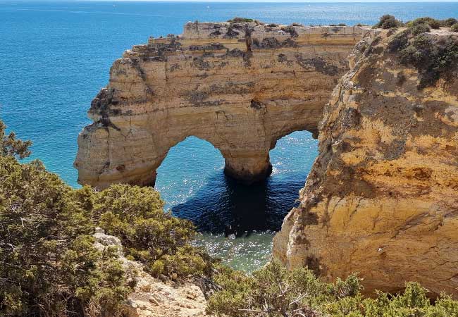
The Praia do Carvalho beach
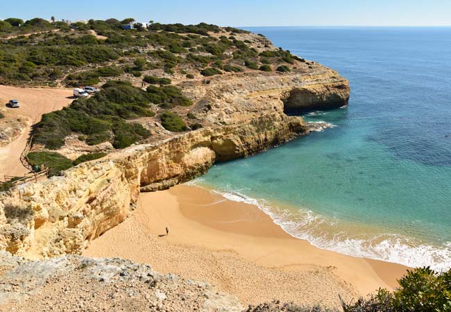
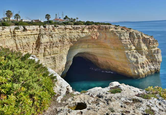
Benagil Cave (the cave can only be entered by boat, but you can look through the hole in the roof)
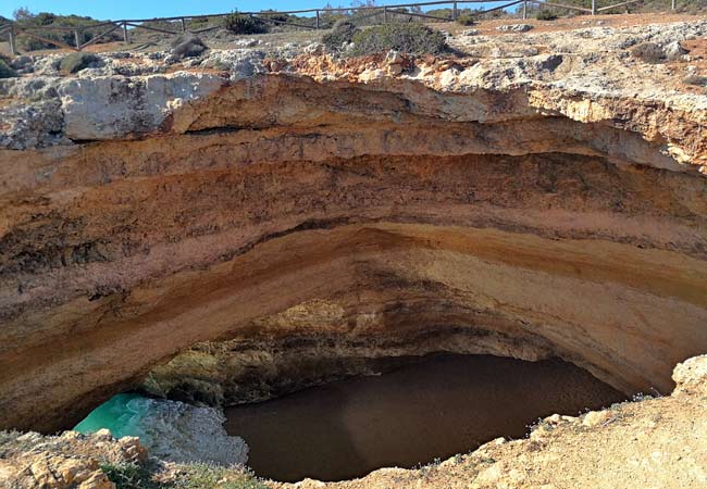
Benagil Cave as seen from the top
The sea caves and rock pillars on the Vale Espinhaço headland
Quick overview of the Percurso dos Sete Vales Suspensos
Below is an interactive map of the Sete Vales Suspensos hiking route. The main route is shown in green with the additional section between Carvoeiro and Vale de Centianes marked in yellow.
Note: zoom in or out if the map is not fully shown
Sights along the hike: 1) Praia do Vale de Centeanes beach 2) Farol de Alfanzina Lighthouse 3) Praia do Carvalho 4) Praia de Benagil 5) Benagil Cave 6) Arcos Naturais (double sea arch) 7) Praia da Marinha
The Carvoeiro and Vale de Centianes sections: 8) Praia de Carvoeiro 9) Algar Seco rock formation 10) Praia de Vale Covo beach
Note: A more detailed map showing except footpaths is provided near the end of this article
Warning…
Please skip over this section if you have an ounce of common sense, but it has to be stated:
• Don’t try to swim to Benagil Caves, at least two tourists die each year from this surprisingly difficult swim.
• Many of the cliffs are sheer with precarious overhangs that may not be apparent from the top; always stick to the paths and avoid risking a fatal slip for a selfie.
• If it’s hot, take enough water as there are surprisingly few locations to purchase food or water
• This is a rough and rocky cliff top walk, which has been eroded by rain. Flip-flops are not suitable footwear – always wear decent shoes.
• We suggest extra care after heavy rains, as this is when cliff collapses are most likely.
• And never, ever try to cycle the path (which I have seen…)
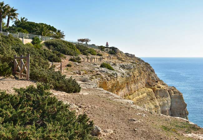
There are some very sheer drops along the route….
Our opinion of the Sete Vales Suspensos
The Percurso dos Sete Vales Suspensos is an outstanding hiking route which encompasses some of the finest natural scenery of the central Algarve.
The trail is very rough in certain sections, but so many visitors hike the route that there are well-worn paths to follow.
The length of the return hike (11.5km) means that it can be accomplished in one long day, (4-6hours) but it may be more pleasant to divide into two sections; Praia da Marinha to Benagil and Benagil to Praia do Vale de Centeanes. Benagil is the only village along the route and makes for a pleasant halfway point.
If you are not a keen walker consider doing just the section from Praia da Marinha to Benagil.
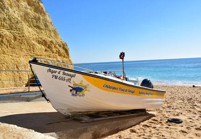
There are boat trips to Benagil cave which depart from Benagil beach
The intense summer sun makes this a demanding hike in July and August. If you are planning to walk in the summer, start early in the day and take lots of water.
The best season to walk the Sete Vales Suspensos is in the spring, when the plants of this harsh environment are in full bloom.
The seven hanging valleys
The Percurso dos Sete Vales Suspensos is named after the seven hanging valleys which are passed along the route. A “hanging valley” is a valley which has been cut above the main valley. In the Sete Vales Suspensos, ancient rivers (35million years ago) cut river valleys through the limestone cliffs but did not erode down to sea level. The mouth of these ancient rivers eroded the sheltered cove beaches, such as seen at Praia do Vale Espinhaço, Praia do Carvalho and Praia de Benagil.
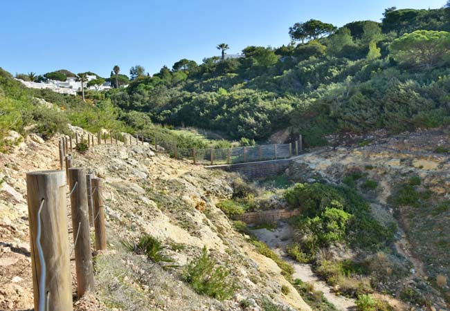
A hanging valley near Alfanzina
Nowadays the Algarve is much drier, with only a trickle of water running down the river valleys in the winter months, and the majority of the rainwater is absorbed by the limestone cliffs. The slightly acidic composition of the rainwater has eroded the limestone to create giant sink holes (such as the two near the Alfanzina lighthouse), caves and underground waterways.
The absorbing property of the limestone also means that the cliffs are incredible arid, with only the hardiest of plants able to survive. Plants which flourish in this dry, hot and saline conditions include Aleppo pine trees and thickets of juniper.
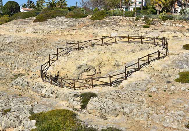
A massive hole in the ground near the Alfanzina lighthouse
Where to begin the Sete Vales Suspensos walk?
Neither of the starting locations is close to a major town, bus stop or anything convenient for tourists, it is a mystery why the route could not have been extended to Carvoeiro or Armação de Pera. There is a large car park at Praia da Marinha, but this will quickly fill up in the summer. Praia do Vale Centeanes has almost no car parking, but it is possible to park in the surrounding residential streets.
If starting in Carvoeiro, it is possible to walk from the town centre to the Algar Seco along the broad walk and then follow the cliffs to the Praia do Vale Centeanes. An alternative is just to walk the 1km along the nondescript Estrada do Farol, to Praia do Vale Centeanes beach.
Map of the Route
The hiking trail is well signed, and the route is quite easy to navigate as it just follows the coastline. For a detailed map of the region, please see OpenStreetMap, an overview is seen below:
To view this map on OpenStreetMap please click here - link opens new window
The map is provided by OpenStreetMap.com, which is an open-source map project and provide some very accurate and detailed maps of Portugal.
We use OpenStreetMap constantly for all of our hiking and exploring of Portugal and highly recommend it.
Our most popular articles for Carvoeiro and the Algarve


